Air Evac
Antiques
Arts & Culture
Assumption Abbey
Attractions Map
Camps, Cabins & RV Parks
Civic Center
Dining
Events & Festivals
Farmers Markets
Historic West Plains
Jan Howard
Lodging
MSU-WP
Ozarks Medical Center
Ozark Mills and Springs
Points of Interest
Recreation & Entertainment
Rivers & Lakes
Real Estate & Properties
Scenic Wilderness
WP Motor Speedway
Additional Links
Calendar of Events
Tourism Calendar
Scenic Wilderness
Mark Twain National Forest | Grand Gulf State Park | The Narrows | Caney Mountain Refuge
Devil's Backbone Wilderness | Tupelo Gum Pond Natural Area | Coward's Hollow Natural Area
White Ranch State Forest | The Ozark Trail | The Ridge Runner Trail | Glade Top Trail
Vanderhoef Memorial State Forest | Jam Up Cave | Rocky Falls | Irish Wilderness
Much of the scenic beauty surrounding West Plains is part of the Mark Twain National Forest. Recreational opportunities are abundant within 11 ranger districts on the 1.5-million acre forest. Included are more than 40 campgrounds and picnic sites, over 350 miles of floatable streams, lakes ranging from 10 to 440 acres, seven congressionally designated wilderness areas totaling over 63,000 acres and 125 miles of trails for bikers and ATV users. Horseback riding, hiking (including three national recreation trails), sightseeing and bird-watching are popular. The National Forest is open year-round, prices vary.
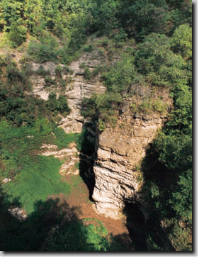
This unique park near Thayer preserves a canyon 3/4 of a mile long with walls reaching as high as 120 feet. It is often called the "Little Grand Canyon." Here, one of the largest natural bridges in Missouri spans a distance of 200 feet over an opening 75 feet high. Water flowing into the remaining subterranean portion of the cave has been traced to Mammoth Spring, Arkansas.
This area is known as "The Narrows" because of the high rocky ridge separating Fredrick Creek and the river. The Narrows is located east of Thayer, between Myrtle and Gatewood. At Morgan Spring Float Camp, a footpath leads to Morgan Spring then up over the ridge to Blue Spring. The dam and rock work on Fredrick Creek above where it joins the river are all that remains of Tommason Mill, which was built around 1908 and operated in the early part of the century.
Master conservationist A. Starker Leopold was hired in 1949 by the Conservation department to prepare its first wildlife management plan on a 6,694 acre tract. The area is host to a diverse wildlife population as well as other natural wonders, including the state record gum tree, resident bald eagle populations and several unique plant communities.
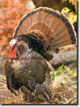
Drivethrough car tours are possible at most times of the year and camping is available in designated areas. Managed deer and turkey hunts, including a fall black-powder hunt are held each year and selfguided nature trails provide diverse and scenic hiking opportunities.
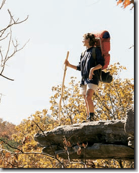
Named by early settlers for a prominent ridge, the Devil's Backbone comprises 6,595 acres of rugged Ozarks' hills and hollows and is noted for its rugged terrain and wild beauty. This area is under special preservation rules as a Wilderness area to maintain it for all adventuring individuals to enjoy. Vehicles are prohibited but 13 miles of Wilderness trails make it accessible by foot and horseback. Raccoon Hollow, McGarr Ridge and Collins Ridge provide entry points as well as the Blue Spring area of North Fork Recreation Area.
*Call the Ava/Cassville/Willow Springs Ranger District at (417) 683-4428 for detailed maps and further information before entering the Devil's Backbone Wilderness or the Ridge Runner Trail.
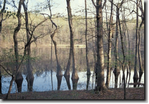
The existence of this stand of water tupelo trees indicates Tupelo Gum Pond is one of the most ancient sinkhole ponds in the Ozark uplands. There are many nearby natural areas that can be visited on the same day.
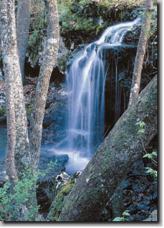
This area is located in a 56-acre portion of the Mark Twain National Forest southwest of Van Buren, Missouri and accessible by Forest Service roads. The natural area contains an unusual chert shutin, chert shelter cave, a 20-foot waterfall and a chert cliff in the lower Ozarks' section. Such a massive bed of Ordovician chert is unusual in Missouri.
This 6,414-acre area has been divided into three tracts and is dominated by forests with deer, turkey, beaver and squirrels. This peaceful wilderness is the perfect place for hiking, birdwatching, picnicking, primitive camping, hunting and fishing. Rifle and pistol ranges were added for practice and enjoyment.

When finished, the Ozark Trail will reach from St. Louis through central and south central Missouri into western Arkansas, a distance of 500 miles. The trail is divided into five sections, one of which passes through the West Plains area. Much of the trail has been completed and designed to accommodate foot, mountain bike and equestrian traffic.
This 22-mile segment of the Ozark Trail extends from Noblett Lake to the North Fork Recreation Area at Hammond Camp. This trail provides access to every kind of Ozarks' vista imaginable. Wildflowers and flowering dogwoods, shadbush and service berry are backdrop to more than 300 species of mammals, reptiles, amphibians and birds. It is a hiker's paradise!
Considered one of the most scenic locations in Missouri, the Glade Top Trail cuts through the Mark Twain National Forest and borders the Hercules Glades Wilderness Area. The trail is a pleasant half-day activity for wildlife and nature enthusiasts. Glade Top Trail is renowned for its enchanting spring and fall landscapes. Annual celebrations of the dazzling fall foliage are held at the Caney Picnic Area along the trail, complete with traditional barbeques and music festivals. Each spring is celebrated with a flowering tour that showcases the dogwood, rosebud, serviceberry and wild fruit trees. The trail travels along ridge tops, providing spectacular views of the glades.
Vanderhoef Memorial State Forest
Donated to the Missouri Dept. of Conservation by the Archie and Gracie Vanderhoef family, which had cared for it since pioneer days. With its nature trail, diversity of native plant life and the West Fork of the Spring River where bass, goggle eye and sunfish abound, the 140-acre forest is a perfect place for nature lovers and fishermen.
Jam Up Cave
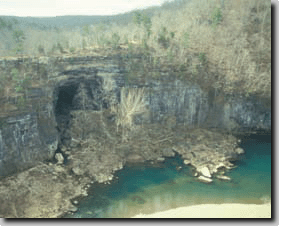
The incredible "doorway" to Jam Up Cave stands eight stories tall and is more than 1,000 feet across. Due to the indirect light reaching deep into this north-facing opening and the large lake within the cave, conditions are perfect for preservation of plant species that have not been seen elsewhere in the Ozarks since the last Ice Age. Access to the cave is only by canoe from the Jacks Fork River.
Photo courtesy of Missouri Dept. of Conservation.
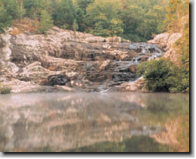
Igneous rock from an ancient lava outflow has combined with thousands of years of falling and flowing water to create this magnificent display of rock and water in conflict. Rocky Creek cascades forty feet down into a pool of cold, clear water that is an excellent swimming hole. The site is on National Forest Service land with a picnic area located nearby. One section of the Ozark Trail passes right by the waterfall. With everything combined, Rocky Falls is the perfect place to swim, have a picnic, explore the waterfall area and do some hiking.
A federal forest preserve of 16,500 acres, the Irish Wilderness was named for a community of Irish immigrants who settled the land and then disappeared during the Civil War. Horseback riding, hiking, biking and camping are favorite activities on the Ozark Trail along the Eleven Point River and its tributaries.
